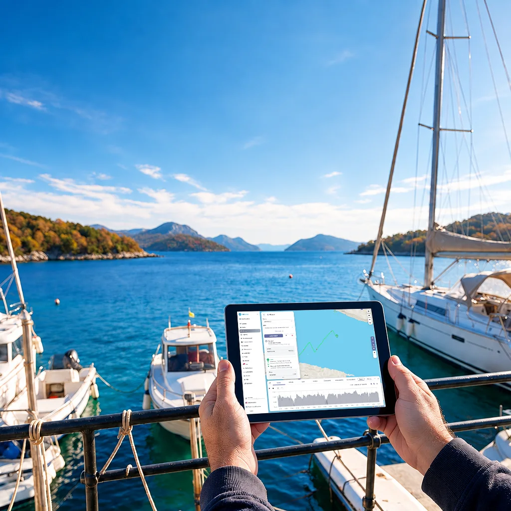
Fleet ready for handover
Location, route history, stops and selected statuses help the team check a vessel's return and availability before the next rental.
GPS Marine is a B2B boat monitoring system for boat rental companies and charter fleet operators. Its web and mobile app combines GPS vessel tracking, route history, geofencing, alerts and available NMEA 2000 telemetry in one operational view.
Your boat rental fleet in one operational view
Route and event history for up to 12 months
Available NMEA 2000 engine and system data
Geofences, sensors and automated alerts
In boat rental operations, a late return, unexpected service requirement or pre-handover issue can affect the next booking. GPS Marine gives the operations team clearer fleet visibility without visiting every vessel.
Location, route history, stops and selected statuses help the team check a vessel's return and availability before the next rental.
Geofences and connected sensors can automatically send push and/or SMS alerts after a registered event, depending on the package and configuration.
Engine hours, available fault codes and other NMEA 2000 data can help plan servicing and reduce unnecessary visits to a vessel.
GPS Marine combines GPS vessel tracking, remote boat monitoring, available marine telemetry and operational alerts for boat rental and charter fleets. Every configuration is tailored to the vessel, its installed electronics and the data the team actually needs.
A GPS device, compatible NMEA 2000 network and selected sensors are connected according to the vessel configuration.
Locations, events and available telemetry are processed in a secure operational system.
The web and mobile GPS boat tracking app gives authorised users access to the fleet, route history, events and available statuses.
NMEA 2000 is an onboard data network connecting compatible engines, instruments and sensors. GPS Marine can bring available data into a remote fleet view so rental and charter teams can plan handovers, servicing and responses to anomalies more effectively.
RPM, operating hours, temperature, oil pressure and available fault codes for better service planning.
Level, consumption and other data made available by the compatible network.
Battery voltage, connected power sources, bilge status and additional inputs.
Supported navigation and environmental data when exposed by the vessel configuration.
Examples of supported NMEA 2000 ecosystems
Available data depends on the model, model year, installed gateway and supported NMEA 2000 messages. We verify compatibility before quotation and installation.
The value of NMEA 2000 telemetry is not simply having more data. It is giving the responsible team earlier visibility of an available anomaly so a check can be arranged before the boat goes out on its next rental.
Check available power, fuel and active alert data before the guest or crew arrives.
Connect location, operating hours and available engine status with the context the operations team needs when a call comes in from the vessel.
Compare operating hours, available consumption and fault codes, then direct servicing towards vessels that require inspection.
Combine GPS boat and vessel tracking, geofences, automated alerts and selected sensors around the way your boat rental or charter fleet operates.
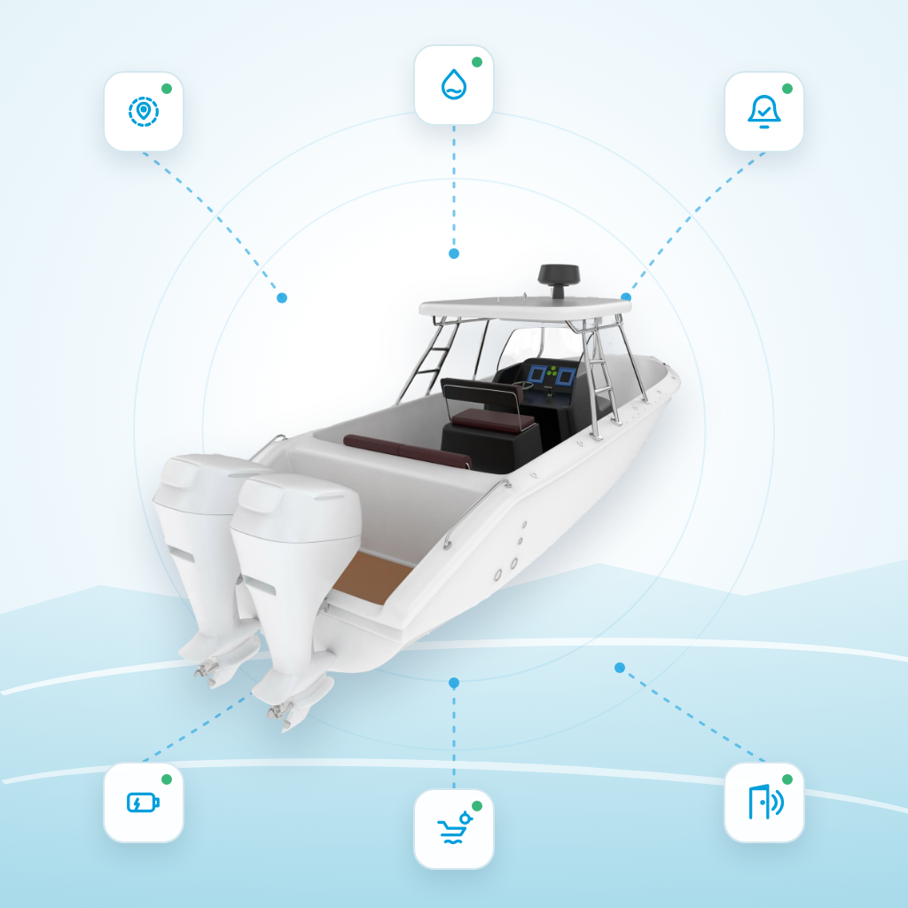
If the device registers movement away from the berth or entry into or exit from a defined zone, the system can send a configured alert.
A connected input or sensor can report bilge pump activity, repeated activation or a detected water level, depending on the installation.
Monitor available voltage and power-loss data so the team can arrange an inspection at the berth sooner.
Autonomous battery-powered trackers can monitor outboard engines, tenders and other assets independently of the vessel's main power supply.
Additional sensors can register opening, movement or another defined event when installed and configured correctly.
The system can automatically send configured alerts 24/7 after a registered event; the channel and delivery depend on the package, device and network.
Selected devices are available with IP67 or IP68 protection and an expected battery life of 3–5 years. The exact specification depends on the model, reporting interval, network, conditions and use.
GPS monitoring and alerts can help prevent or reduce the consequences of theft, water ingress and other incidents, but they do not guarantee that an incident will not occur.
There is no single configuration for every vessel. The GPS device, enclosure protection, power source and mobile network are selected around the required reporting frequency, cruising area and installation method.
Selected GPS devices are available with IP67 or IP68 protection. The exact rating and suitability for the installation location are confirmed against the technical data sheet for the specific model.
Configurations that require more frequent data exchange can use devices with 4G/LTE connectivity, depending on the model, tariff, coverage and roaming.
Low-power mobile networks such as LTE-M and NB-IoT can suit selected sensors and trackers where low energy use and intermittent reporting matter. Availability is checked by market and operator.
Selected models have an expected battery life of 3–5 years, depending on the reporting interval, network, temperature, conditions and use.
The GPS device, antenna, sensors, communication technology and reporting interval are selected as one configuration. 4G, LTE-M and NB-IoT availability is not the same in every marina, country or roaming zone.
Selected cameras can supplement location, time and alert data with a photograph, short clip or remote view. Available functionality depends on the camera, device, mobile connection, tariff and vessel configuration.
A photograph or short clip can help verify what occurred around a movement alert, geofence exit or another configured event.
The operations team gains additional context before contacting the user, dispatching service staff or arranging an inspection at the marina.
Controlled access to relevant footage can support the review of damage, a disputed event or a recurring operational issue.
Video telematics requires a clearly defined purpose, lawful basis, notice to individuals, restricted access and a defined retention period. Cameras must not be installed in spaces where crew or guests reasonably expect privacy.
GPS Marine is primarily a B2B solution for boat rental companies and charter fleets, while configurations can also support companies that build, equip, service or manage vessels.
A unified view of location, use and available status across multiple vessels supports handovers, inspection scheduling, service planning and reduced unplanned downtime.
The GPS, NMEA 2000 and sensor configuration can be planned while a new vessel is being equipped so devices, power and available data are aligned before delivery.
Marine electricians and service companies can discuss cooperation covering vessel assessment, installation, maintenance and the sale of GPS Marine solutions to their business customers.
Visibility of available alerts and status can support inspections at the berth and coordination of work with the owner or fleet operator.
The cooperation model, sales territory, resale terms and technical responsibilities are confirmed in a separate agreement.
Discuss a solution or partnershipEnter basic fleet data to see the indicative value of active GPS Marine monitoring. GPS Marine uses the GPS Cloud platform.
The hull insurance saving is based on an indicative 12% discount on an average annual premium equal to 0.5% of vessel value. Results are informational and depend on the insurer, configuration and usage.
Boat monitoring pricing depends on the number of vessels, selected devices, sensors, communication zone and installation method.
Choose an equipment purchase with no contractual commitment or monthly hardware rental with GPS Marine service under a 36-month contract.
Purchase hardware at a starting price from EUR 80, followed by a subscription from EUR 8 per month per vessel.
Pay three months in advance and choose a package without hardware or with hardware included in the first billing period.
The prepaid price from EUR 49.95 covers three months of service and does not include hardware.
All prices are starting B2B prices per vessel, excluding VAT and other applicable taxes. NMEA 2000, additional sensors, installation and the communication zone may affect the final quotation.
GPS Marine is designed for boat rental companies, charter fleets and other business users managing multiple vessels or connected marine assets. This web offering is not intended for private owners of individual boats.
GPS Marine uses an installed GPS device to monitor your own business fleet in a private operational view. AIS exchanges identification and navigation data from equipped vessels and may be visible in public services. NMEA 2000 is the onboard data network that can expose engine, fuel, power and sensor data when supported by the vessel configuration.
A broad range of integrations is available for NMEA 2000-compatible equipment, but the data set is not the same on every vessel. We check compatibility before quotation and installation.
This depends on the engine, gateway, sensors and supported PGNs. Possible data includes RPM, operating hours, temperature, oil pressure, fuel, power and other statuses exposed by the vessel configuration.
An asset tracker has its own battery supply, allowing it to monitor detached assets independently of the vessel's main power. Selected models have an expected battery life of 3–5 years, depending on settings and conditions of use.
The system can automatically generate push and/or SMS alerts 24/7 after a registered event. Available channels depend on the package, configuration, network and device; this is not the same as 24/7 human support.
Route and event history is available for up to 12 months.
Some insurers may consider installed equipment when setting policy terms. Eligibility and any discount depend solely on the insurer, policy, installed equipment and its assessment. GPS Marine does not guarantee a discount.
GPS Marine hardware purchase starts from EUR 80. With an equipment purchase, the monthly subscription starts at EUR 8 per vessel with no contractual commitment. Monthly hardware rental and service start at EUR 7 per vessel with a 36-month contract. Prepaid service without hardware starts at EUR 49.95 for three months, or starts at EUR 129.95 with hardware in the first billing period. All prices exclude VAT and other applicable taxes.
Yes, when the GPS device registers movement or entry into or exit from a defined geofence. The system can then generate a configured push and/or SMS alert, depending on the device, package and mobile network availability.
Depending on the vessel, the configuration uses available NMEA 2000 data, additional inputs or separate sensors. The system can report recorded bilge pump activity, water level, a voltage drop or shore power loss, but each function must be included in the specific configuration.
Yes. We are open to discussions with marine electricians, service companies, installers and other B2B partners. Sales territory, installation approach, support, commercial terms and technical responsibilities are defined in a separate partner agreement.
Yes, with selected compatible cameras and a suitable mobile connection. Photographs, short clips or remote viewing depend on the device, tariff and configuration. Before activation, the business user must define the purpose, lawful basis, notices, authorised access and footage retention period.
Tell us the number and type of vessels, the length of your season and the data you want to monitor. We will recommend a GPS, NMEA 2000 and sensor configuration for a demonstration or quotation.
Emailprodaja [at] gps-cloud.com
Support hours: Mon–Fri, 08:00–17:00
Let's match your rental or charter fleet with GPS boat tracking, available NMEA 2000 data and selected sensors.